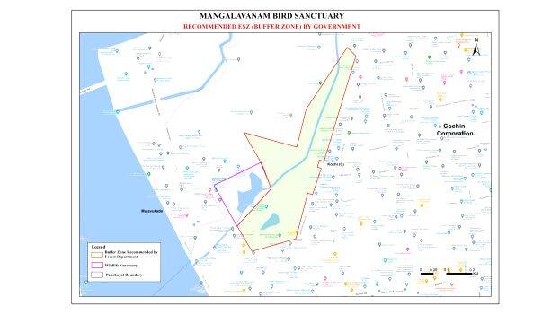

KOCHI: There is confusion in the draft map released by the government on Wednesday regarding the ecologically sensitive zones around national parks and wildlife sanctuaries.
There is no connection between the map published by the Forest department on the 12th and the map on Wednesday. In the map published on the website of the Forest department on 12th, a buffer zone of one kilometre around 22 forest zones of the state have been recorded along with the survey number. On the other hand, in the map published yesterday as a draft to be submitted to the Supreme Court, the residential area has been completely excluded and a 'zero' buffer zone has been recorded.
At the same time, the government claims that the preliminary report prepared through satellite images regarding institutions, houses, other constructions and various activities within one kilometre of protected areas in the state has been published earlier. It has also been directed to inform the missing information available to the Joint Secretary, Forest and Wildlife Department, 5th Floor, Secretariat Annex 2, Thiruvananthapuram 695001 by January 7.
A major part of Kochi Corporation comes under buffer zone
Mangalavanam Bird Sanctuary is a national park having only 2.74 hectares (0.0274 sq km) which is situated in the heart of Kochi city. According to the map published by the forest department, more than ten times of this area, that is lion's share of the Kochi municipality will be in the buffer zone. In the draft map published by the state government yesterday, the urban area is barely included. The buffer zone in the new map is only a few uninhabited areas near the High Court.
“There is no clarity in the government's action. It is suspected that the zero buffer zone noted in the new map is a measure to cool down the protesters.”, said Rev. Sebastian Kochupurackal, Chairman, High Range Conservation Committee.