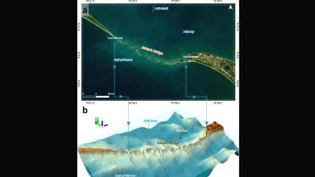

THIRUVANANTHAPURAM: The Indian Space Research Organisation (ISRO) successfully mapped the Ram Setu bridge, connecting India with Sri Lanka. NASA provided satellite images and collaborated on the project. Researchers hope the results to help in the detailed study of the bridge, which is now submerged in the waters.
According to legend, Ram Setu was built by Lord Rama with the help of Vanarasena to save Sita from Ravana. It is disputed that the bridge is mythical and was formed naturally in the sea. Mapping by ship was not possible due to the shallow depth where Ram Setu is located.
Ram Setu stretches from Rameshwaram Dhanushkodi in Tamil Nadu to Talaimannar on Mannar Island in Sri Lanka. The Gulf of Mannar in Sri Lanka is 48 km from Dhanushkodi. In the 9th century AD, Persian sailors called it 'Setu Bandhai' or the sea bridge connecting India and Sri Lanka. Some parts of it can be seen above the sea during low tide. According to Rameswaram temple records, the bridge was above water till 1480. It is also recorded that the bridge was submerged in a cyclone.