


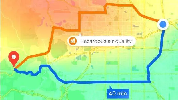
Google Maps which provides real-time GPS navigation, traffic, etc., will provide information of the level of air pollution at the destination from now on. There will also be an explanation of how air quality affects health. The feature is in an updated version of Google Maps. The service will be available on Both Android and iPhones. It can be downloaded from the Play Store.
Globally, this feature is available in 40+ countries, including India. If air pollution is high in the area, Google Maps will warn or suggest a less polluted route.
Google Maps collects basic information from the central and state pollution control boards. The index will vary depending on the wind speed, direction and topography. Normal Air quality indicators are updated within 24 hours. The one on Google Maps will be updated every hour.
Different color, number
Numbers from zero to 500 will also be shown on the map.















 HOME
 LATEST
 NOTIFIED NEWS
 POLL
 KERALA
 EDITORIAL
 INDIA
 WORLD
 BUSINESS
 CINEMA
 SPORTS
 LIFESTYLE
 SPECIAL
 SCIENCE & TECHNOLOGY

 |