


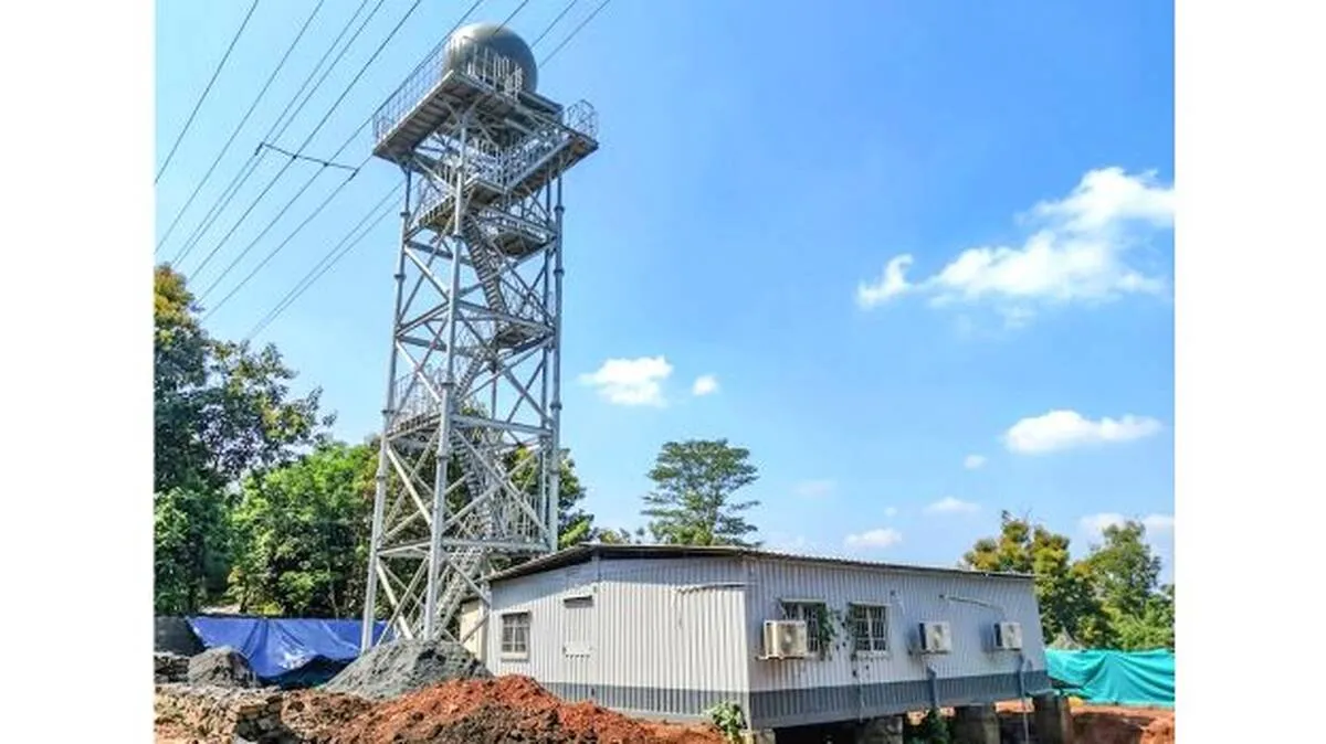
THIRUVANANTHAPURAM: A Rs 10-crore X-band Doppler Weather Radar, installed to provide early warnings of extreme rainfall and possible cloudbursts, is yet to be commissioned, raising concerns over Kerala's flood preparedness. The Pinarayi Vijayan government had decided to install the advanced radar system at Pulpally in Wayanad after the devastating Mundakkai-Chooralmala disaster, which claimed more than 400 lives. The radar is capable of detecting weather conditions that could lead to cloudbursts.
The project was taken up with the aim of making it operational before this year's monsoon. Construction was completed in May. However, it could not be commissioned due to the Model Code of Conduct for the elections. After the new government assumed office, no further action was taken to make the system operational. Unlike conventional weather monitoring systems, Doppler weather radars can detect rain-bearing clouds that may trigger cloudbursts. Kerala has witnessed repeated flood disasters since 2018, highlighting the need for such advanced forecasting systems.
Experts have urged the government to commission the radar without further delay. Technical experts will have to be appointed to operate the system. ISRO had earlier informed the government that it could provide training on the radar's software, but no follow-up action has been taken. Pulpally, located at a higher altitude in Wayanad, was selected to ensure maximum weather surveillance coverage across Kerala. India currently has 47 Doppler weather radars, most of which are installed in the Himalayan region.
The radar sends electromagnetic waves towards rain clouds. These waves penetrate the clouds and are reflected back to the radar. By analysing the changes in the returning signals using specialised software, experts can determine whether the clouds have the potential to cause a cloudburst, estimate the intensity of rainfall, predict when it may occur, how long it is likely to last, and identify the areas that could be affected.
A cloudburst is an extremely intense rainfall event that occurs within a short period. When sea surface temperatures rise, large amounts of water vapour are generated and carried upward by winds. As the moisture-laden air reaches mountainous regions, it gets trapped and condenses rapidly due to heat over land and the presence of tiny airborne particles known as aerosols. This rapid condensation results in extremely heavy rainfall over a limited area.
As land temperatures increase, the rate of condensation also rises, making the rainfall even more intense. Rain that would normally fall over two days can pour down within just two or three hours. Since the ground cannot absorb such a large volume of water in a short time, it leads to flash floods. The sudden surge of water can also trigger landslides and mudslides.















 HOME
HOME LATEST
 NOTIFIED NEWS
 POLL
POLL KERALA
  EDITORIAL
  INDIA
INDIA  WORLD
WORLD  BUSINESS
  CINEMA
  SPORTS
  LIFESTYLE
  SPECIAL
  SCIENCE & TECHNOLOGY
 |
|